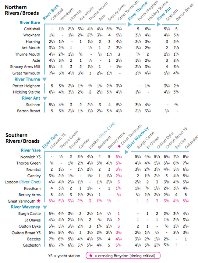
Without a doubt, the most magical way to discover the Broads is by boat. The waterways of the Broads are safe and easy to navigate, with over 125 tranquil, lock-free miles to explore. So much of the Broads can’t be reached by road that days – and nights – afloat become a real adventure, with hidden places, perfect fishing spots and close encounters with wildlife at every turn. The area map, journey times and moorings information below will help you plan your journey. There are numerous free moorings on the Norfolk Broads that can be used for 24 hour periods. As well as those listed below there are some at boat yards, pubs and staithes but charges may apply.
Speed limits are in force throughout the Norfolk Broads of 3, 4, 5 or 6mph. These limits are clearly signed. The journey times below can be used as a rough guide but please remember that traffic, tide and weather may have an effect.